Thomas Jefferson’s Land Grant for Natural Bridge and 157 Acres in Botetourt County
Thos Jefferson 157 acres Form pages
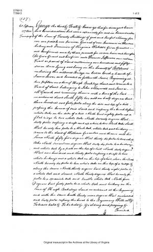
George the third &c To all &c Know ye that for divers good Causes and Considerations but more especially for and in Consideration of the Sum of Twenty Shillings of good and lawful Money for our use [. . .] paid to our Receiver General of our Revenues in this our Colony and Dominion of Virginia We have Given Granted and Confirmed and by these presents for us our heirs and Successors Do Give Grant and Confirm unto Thomas Jefferson one certain Tract or parcel of Land containing one hundred and fifty seven Acres lying and being in the County of Botetourt including the natural Bridge on Cedar Creek a branch of James River and bounded as followeth, to wit, Beginning at two poplars on a line of Hugh Barkley’s Land and corner to a Tract of Land belonging to John Maxwell and James M’Gavock and running thence with a line of the last mentioned Land South fifty two and an half degrees East three hundred and forty poles along the side and top of a hill passing the Corner of said Land and crossing the Creek to four white Oaks on the side of a hill North East eighty poles up a flat ridge to two white Oaks North seventy degrees West Sixty poles crossing a draft and up a hill to two black Oaks South West twenty two poles to a black Oak, white Oak and hickory corner to the Land of William Greenlee and thence with his lines North fifty five degrees West thirty six poles to two white Oaks North seventeen degrees West sixty six poles to a hickory and white Oak by a path on the top of a hill North sixty degrees West one hundred and thirty poles crossing a draft to two white hickory’s and a white Oak on the top of a hill above the Creek North twenty six poles to two white Oaks on the top of a ridge & along the same North thirty degrees East thirty eight poles to a white Oak and Locust North thirty degrees West twenty fou[r] poles to a spanish Oak and Double white Oak North four Degrees East forty poles to a white Oak and hickory on the line of Hugh Berkeley’s Land mentioned at the Beginning and with the same South thirty nine degrees West one hundred and sixty poles crossing the Creek to the Beginning With all &c To have hold &c To be held &c Yielding and paying &c Provided &c In Witness &c Witness our trusty and welbeloved John Earl of Dunmore our Lieutenant and Governor General of our said Colony and Dominion at Williamsburg under the seal of our said Colony the fifth Day of July one thousand seven hundred and seventy four in the fourteenth year of our Reign—
Exd